🎉 Up to 70% Off Selected ItemsShop Sale

$32.11
G11 North Ionian Islands—
$32.11
The Story
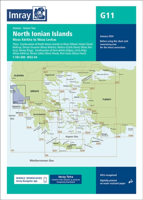
Plans included: Continuation of North Ionian Islands to Nisís Othoní (1:185 000) Vórion Stenó Kérkiras (1:70 000) Órmos Gouvíon (Nísos Kérkira) (1:25 000) Kérkira (Corfu Town) (Nísos Kérkira) (1:25 000) Órmos Párga (1:10 000) Continuation of Amvrakikós Kólpos (1:185 000) Limín Alípa (Nísos Kérkira) (1:10 000) Órmos Lákka (Nísos Paxoí) (1:7500) Port Gaios (Nísos Paxoí) (1:10 000) Imray-Tetra charts for the Ionian and Aegean are widely acknowledged as the best available for the cruising sailor. They combine the latest official survey Digital with first-hand information gathered by Rod and Lucinda Heikell. The chart is designed to be used alongside Imray pilot guides of the area. Like all Imray charts, they are printed on water resistant Pretex paper for durability, and they include many anchorages, facilities and inlets not included on official charts. This edition includes the latest official Digital combined with additional information sourced from Imray's network to make it ideal for small craft. It includes the latest official bathymetric surveys. There has been general updating throughout.
Details & Craftsmanship
Every detail has been carefully considered to bring you the perfect product.
Description
Plans included: Continuation of North Ionian Islands to Nisís Othoní (1:185 000) Vórion Stenó Kérkiras (1:70 000) Órmos Gouvíon (Nísos Kérkira) (1:25 000) Kérkira (Corfu Town) (Nísos Kérkira) (1:25 000) Órmos Párga (1:10 000) Continuation of Amvrakikós Kólpos (1:185 000) Limín Alípa (Nísos Kérkira) (1:10 000) Órmos Lákka (Nísos Paxoí) (1:7500) Port Gaios (Nísos Paxoí) (1:10 000) Imray-Tetra charts for the Ionian and Aegean are widely acknowledged as the best available for the cruising sailor. They combine the latest official survey Digital with first-hand information gathered by Rod and Lucinda Heikell. The chart is designed to be used alongside Imray pilot guides of the area. Like all Imray charts, they are printed on water resistant Pretex paper for durability, and they include many anchorages, facilities and inlets not included on official charts. This edition includes the latest official Digital combined with additional information sourced from Imray's network to make it ideal for small craft. It includes the latest official bathymetric surveys. There has been general updating throughout.